
Best Scenic Drives in California: 7 Routes Worth It (2026)
 Abdul WadoodLast updated
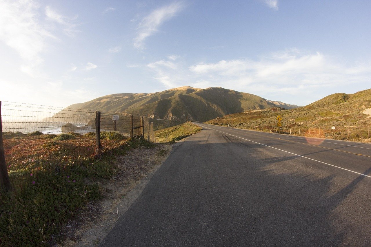
California packs more landscapes into one state than most countries manage in a continent. There are glaciers and deserts, old-growth redwood forests and volcanic badlands, all connected by a road network that often feels designed for the drive itself rather than the destination. That is not an accident. The state’s Scenic Highway program, one of the oldest in the country, officially designates dozens of routes for their visual quality, and the result is a menu of drives that range from a 90-minute coastal loop to a full-day mountain crossing.
The trick is knowing which drives reward the time and which ones just look good on a postcard. Some famous routes are spectacular but slow and crowded. Others are overlooked and empty. What follows is a practical, honest guide to the best scenic drives in California, with the kind of detail you only learn after getting stuck behind a camper van on a two-lane cliff road.
What Makes a California Scenic Drive Worth It
Before the list, a quick reality check. A scenic drive needs more than a pretty road. Three things separate a great route from a frustrating one.
Timing matters more than the route. The Pacific Coast Highway at 8 a.m. on a Tuesday is a different road from the same highway at noon on a summer Saturday. Coastal fog, known locally as “June Gloom,” can swallow an entire ocean view until early afternoon. Mountain passes close for snow. Desert drives become dangerous in July heat.
Distance is deceptive. A 90-mile coastal stretch can take three hours because of curves, traffic, and the fact that you will stop constantly. A 200-mile desert run might take two and a half hours because the road is straight and empty.
The best drives have escape hatches. A good scenic route offers side roads, pullouts, and small towns where you can bail out, eat, or wait out weather. Routes without them turn a beautiful day into a hostage situation.
With that framework, here are seven drives that consistently earn their reputation.
1. Pacific Coast Highway Through Big Sur
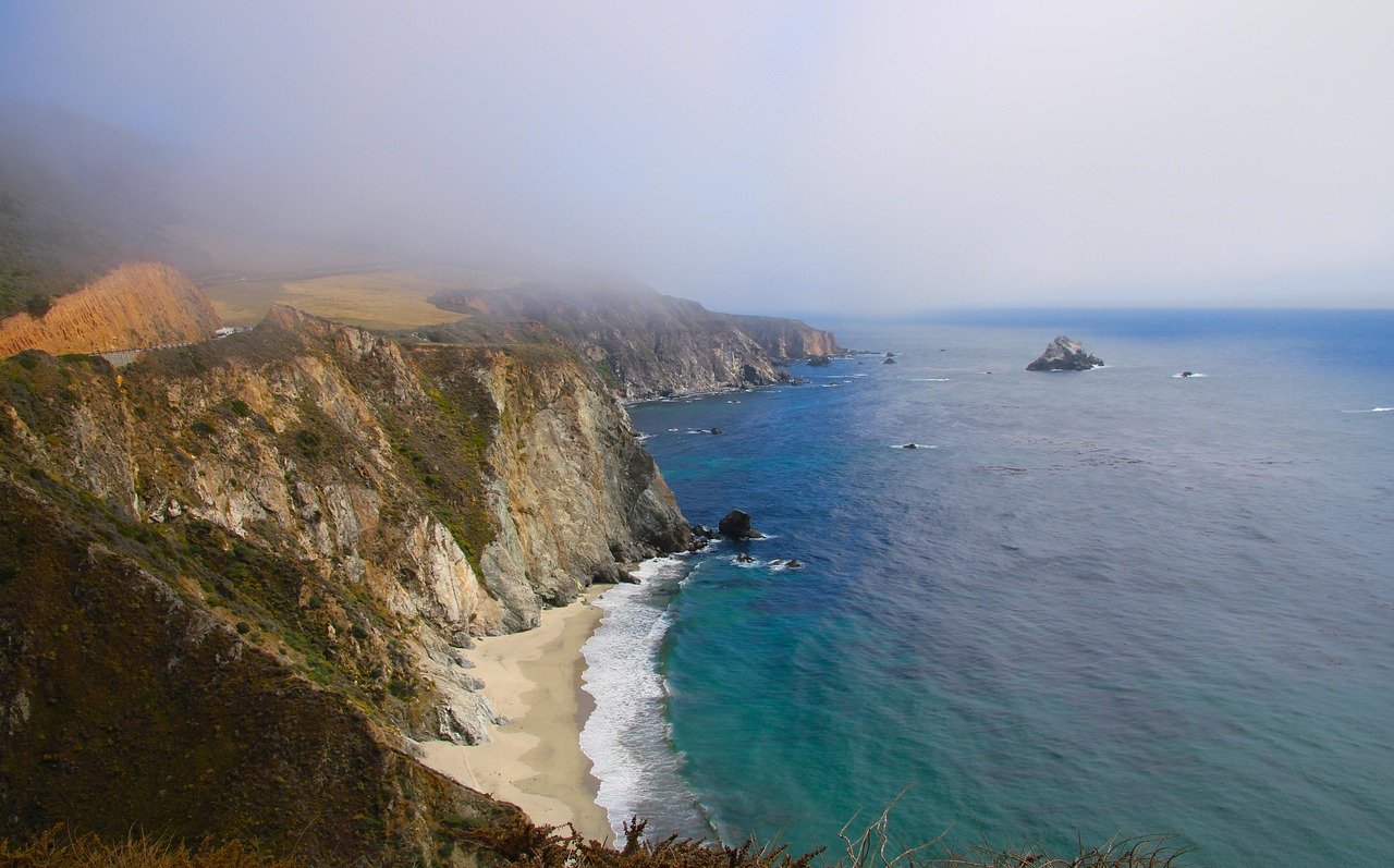
This is the drive people picture when they think of California, and for once the hype holds up. The roughly 90-mile stretch of Highway 1 between Carmel and San Simeon threads along cliffs above the Pacific, with the Bixby Creek Bridge (a concrete arch span opened in 1932) and McWay Falls, a waterfall that drops onto a beach, as the signature stops.
What makes it work is the pacing. The road is slow by design, twisting through redwood gullies and emerging onto open coastal bluffs. Pullouts are frequent, and the state parks along the route, including Pfeiffer Big Sur and Julia Pfeiffer Burns, give you reasons to stop beyond the view.
The catch is fragility. Landslides close sections of Highway 1 with some regularity, sometimes for months. Before committing, check current road conditions with the state transportation agency, Caltrans, which posts closures and chain controls in real time. A route that was open last spring may be a construction zone this summer.
Practical tip: Drive it north to south if you can. Southbound traffic hugs the cliff side, and the pullouts on the ocean side are easier to enter and exit.
2. Avenue of the Giants Through Humboldt Redwoods
South of Eureka, Avenue of the Giants (officially CA-254) runs parallel to US-101 through Humboldt Redwoods State Park, passing directly through groves of old-growth coast redwoods. The road was bypassed by the modern highway in the 1960s, which is exactly why it works: it is quiet, shaded, and lined with trees that predate the Roman Empire.
This is a drive best done slowly and on foot. The 32-mile route has dozens of pullouts, and the Founders Grove and Rockefeller Forest trailheads are worth real time. Redwoods are hard to photograph and easy to under-appreciate from a moving car.
The park itself is managed by California State Parks, which publishes grove maps and seasonal notices. Fog and rain are common even in summer, so pack layers. The canopy keeps the road dim, and wildlife, especially Roosevelt elk, sometimes wanders onto the pavement.
3. Tioga Pass Road Through Yosemite
Tioga Road (CA-120) crosses the Sierra Nevada through Yosemite National Park and reaches Tioga Pass at nearly 9,950 feet, the highest highway crossing in the range. The drive climbs from pine forest into granite high country, past Tenaya Lake and Olmsted Point, where the view back toward Half Dome is one of the finest in the park.
The defining feature of this drive is its season. Snow closes the road most years from roughly November until late spring or early summer, and the opening date shifts by weeks depending on the winter. The National Park Service tracks road status and posts opening announcements each spring, and checking before you go is not optional. Arriving to find a locked gate after a two-hour approach is a common and avoidable mistake.
Common mistake: Treating Tioga as a through-route on a tight schedule. The pass sits above 9,000 feet, altitude affects some travelers, and afternoon thunderstorms build quickly in summer. Start early, and plan to be off the high section by mid-afternoon.
4. 17-Mile Drive in Pebble Beach
This is the odd one out, and it is worth being clear about why. 17-Mile Drive is a private toll road through the Del Monte Forest on the Monterey Peninsula, not a public highway. It winds past the Lone Cypress, Spanish Bay, and several famous golf courses, and the ocean views are genuinely excellent.
It earns a place on this list because it is convenient. It packs coastal drama into a short, easy loop that works for travelers with limited time, mobility constraints, or small children. But it is also the most commercial drive here, with a gate fee, strict rules, and a slightly curated feel.
What actually works: Go at opening time. The light is better, the crowds are thinner, and the golf traffic has not yet arrived. If you want the wild version of the same coastline, drive the free section of Highway 1 south of Carmel instead.
5. Death Valley Scenic Loops
Death Valley is the largest national park in the contiguous United States, and its drives are unlike anything else in California. Artists Drive is a short, one-way loop through eroded volcanic hills striped in pastel pinks and greens. Twenty Mule Team Canyon winds through badlands where the road feels carved into the rock itself. Badwater Road runs south past the lowest point in North America.
The scenery is stark and strange, and the light in early morning and late afternoon turns the rock into something almost artificial.
The non-negotiable rule is heat. Summer temperatures routinely exceed 120°F, and the park service treats that as a genuine safety hazard, not a novelty. Cars overheat, cell service is spotty, and shade is scarce. The National Park Service advises carrying extra water, telling someone your route, and avoiding hikes in the heat of the day. Winter and early spring are the sane seasons for these drives.
6. Route 66 Remnants Near Barstow and Needles
Route 66 was decommissioned as a U.S. highway in 1985, but California retains stretches of the old alignment through the Mojave Desert. The segments near Barstow and Needles are atmospheric rather than dramatic: roadside diners, vintage motels, and long empty two-lane stretches that feel like a time capsule.
This is a drive for people who like texture more than spectacle. It is not as beautiful as Big Sur and not as strange as Death Valley, but it has a specific American melancholy that is hard to find elsewhere. The history of the route is well documented on Wikipedia’s Route 66 page, which is a reasonable starting point before you go.
Practical tip: Fuel up before you leave the interstate. Gas stations on the old alignment are sparse and sometimes closed without warning.
7. The Mendocino Coast on Highway 1
North of San Francisco, Highway 1 runs through Sonoma and Mendocino counties along a coast that is wilder, colder, and far less crowded than Big Sur. The route passes through Jenner, Fort Ross, and Mendocino itself, a village of wooden water towers perched on a headland.
The appeal here is space. Traffic is light, the towns are small, and the coastline has a rugged, weather-beaten quality. Fog is common, and the ocean is cold enough that swimming is a brief and brave activity. But the drives through the pygmy forests and along the cliffs are quietly spectacular.
Comparing the Drives
| Drive | Region | Best Season | Typical Time | Crowd Level |
|---|---|---|---|---|
| Pacific Coast Highway (Big Sur) | Central Coast | Spring, Fall | 3–4 hours | High |
| Avenue of the Giants | North Coast | Year-round | 1–2 hours | Moderate |
| Tioga Pass Road | Sierra Nevada | June–October | 2–3 hours | High |
| 17-Mile Drive | Monterey Peninsula | Year-round | 1–2 hours | High |
| Death Valley Loops | Mojave Desert | Nov–March | 2–5 hours | Low |
| Route 66 Remnants | Mojave Desert | Spring, Fall | 2–3 hours | Very low |
| Mendocino Coast | North Coast | Summer, Fall | 3–4 hours | Low |
Mistakes That Ruin a Scenic Drive
A few patterns show up again and again among travelers who end up disappointed.
Underestimating drive times. Coastal and mountain roads average 30 to 40 mph, not highway speeds. Plan for stops and curves.
Ignoring seasonal closures. Tioga Pass and parts of Highway 1 close for months at a time. Check conditions the morning you leave, not a week before.
Skipping fuel and water. Remote stretches in the desert and along the northern coast have long gaps between services.
Driving into fog and calling it a wash. Coastal fog often burns off by early afternoon. A flexible schedule turns a gray morning into a golden one.
Treating the drive as transit. The best California drives reward stopping. The pullouts exist for a reason.
For more practical travel and route planning content, Voozon Media covers destination guides and road-trip logistics.
Conclusion
The best scenic drives in California are not a single list so much as a set of trade-offs. Big Sur delivers drama at the cost of crowds and closures. Tioga Pass offers alpine spectacle but only for half the year. The desert routes trade beauty for emptiness and a real safety edge. The redwood and Mendocino drives sit somewhere in between, quieter and easier to enjoy without a plan.
What separates a good road trip from a great one is rarely the route itself. It is the timing, the willingness to stop, and the discipline to check conditions before leaving. Pick two drives rather than five. Drive them slowly. Let the fog lift on its own schedule.
FAQ
What is the single best scenic drive in California?
For most travelers, the Pacific Coast Highway through Big Sur is the strongest single choice. It combines dramatic coastline, accessible pullouts, state parks, and a manageable length of about 90 miles. Travelers who prefer mountains should consider Tioga Pass Road instead, provided it is open.
When is the best time to drive the Pacific Coast Highway?
Spring and fall offer the best balance of weather and crowds. Summer brings fog and heavy traffic, especially on weekends. Winter storms can trigger landslides that close sections of the road, so check current conditions before departing.
Is 17-Mile Drive worth the toll?
It depends on your priorities. The drive is convenient, compact, and scenic, which makes it a good fit for short visits or travelers with limited mobility. Those seeking wilder coastline will find the free sections of Highway 1 more rewarding.
Can you drive Tioga Pass in winter?
No. Tioga Road closes to vehicles when snow accumulates, typically from November until late spring or early summer. The exact opening date varies each year, and the National Park Service announces it when plowing is complete.
Is it safe to drive through Death Valley in summer?
It is risky. Summer temperatures regularly exceed 120°F, and the park service warns against prolonged exposure. If you drive in summer, carry extra water, avoid hiking midday, and tell someone your route. Winter and early spring are far safer.
How many days do you need for a California scenic drive trip?
Two drives over three to four days is a realistic pace. Trying to cover five or more routes in a week usually means spending most of the trip behind the wheel. Choose a region, such as the Central Coast or the Sierra, and go deep rather than wide.